Change Is Hard

…but change is certain.


33 Comments

So, as I was saying…

Let’s see, before Katie decided you needed a Katie fix I was about to take you over the Mackinaw Bridge and on into the Upper Peninsula of Michigan. My friend, who was in the passenger seat, got some really cool shots of the bridge as we drove over it. I should ask her to share them here…but meanwhile let’s go see what we saw once we left downstate behind.

On our way to a lighthouse.

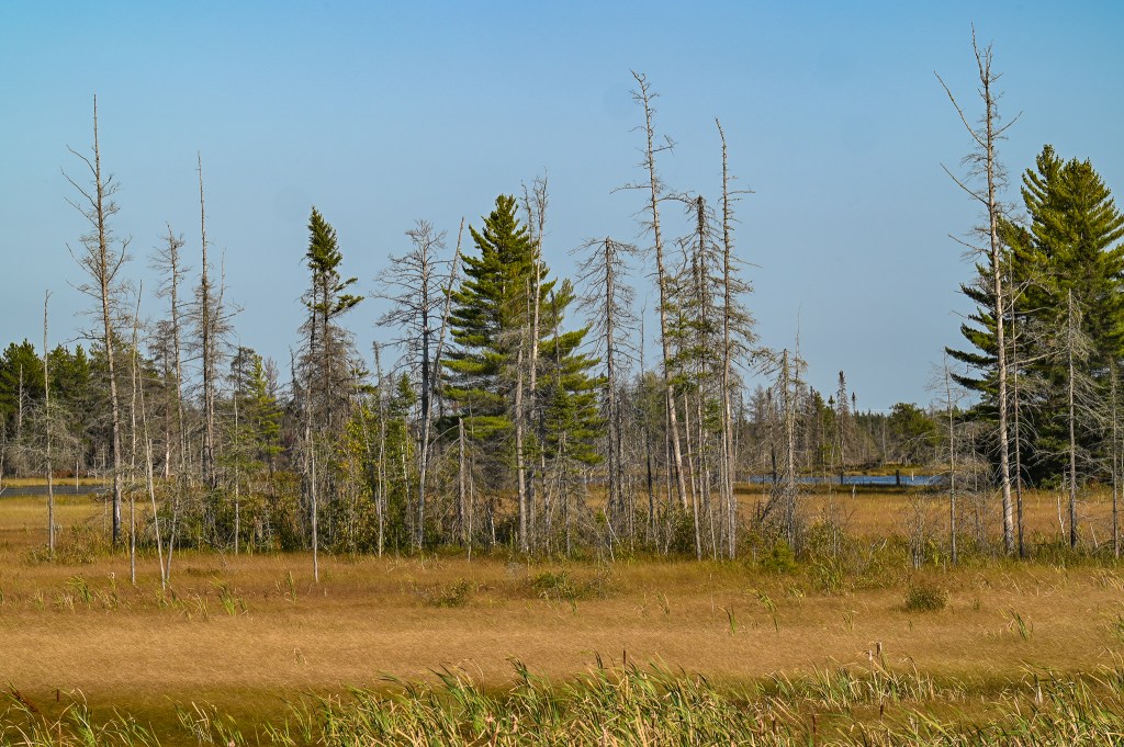
You might think that the UP (short for Upper Peninsula) is nothing but trees and lakes and mosquitos. You would, of course, be wrong. Thought not far wrong…there’s plenty of all that too.

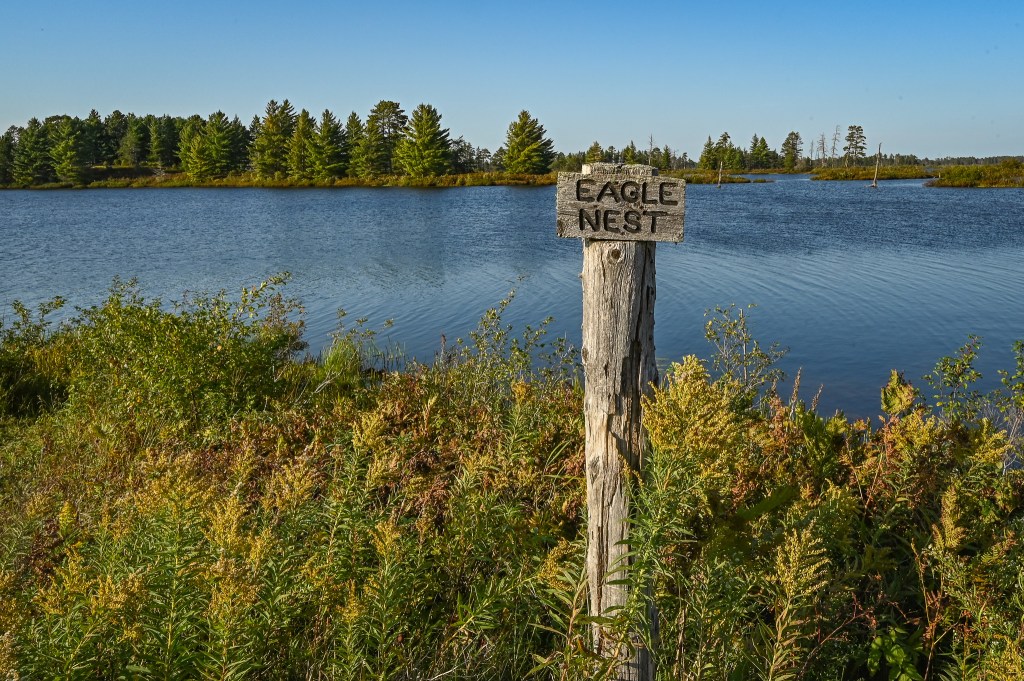
For example there’s the lighthouses. Did you know Michigan has more lighthouses than Maine? Yea…I forgot, I told you that factoid a few years ago when we were traveling in Maine.

This one is in Mackinaw City, at the Southern end of the big bridge.

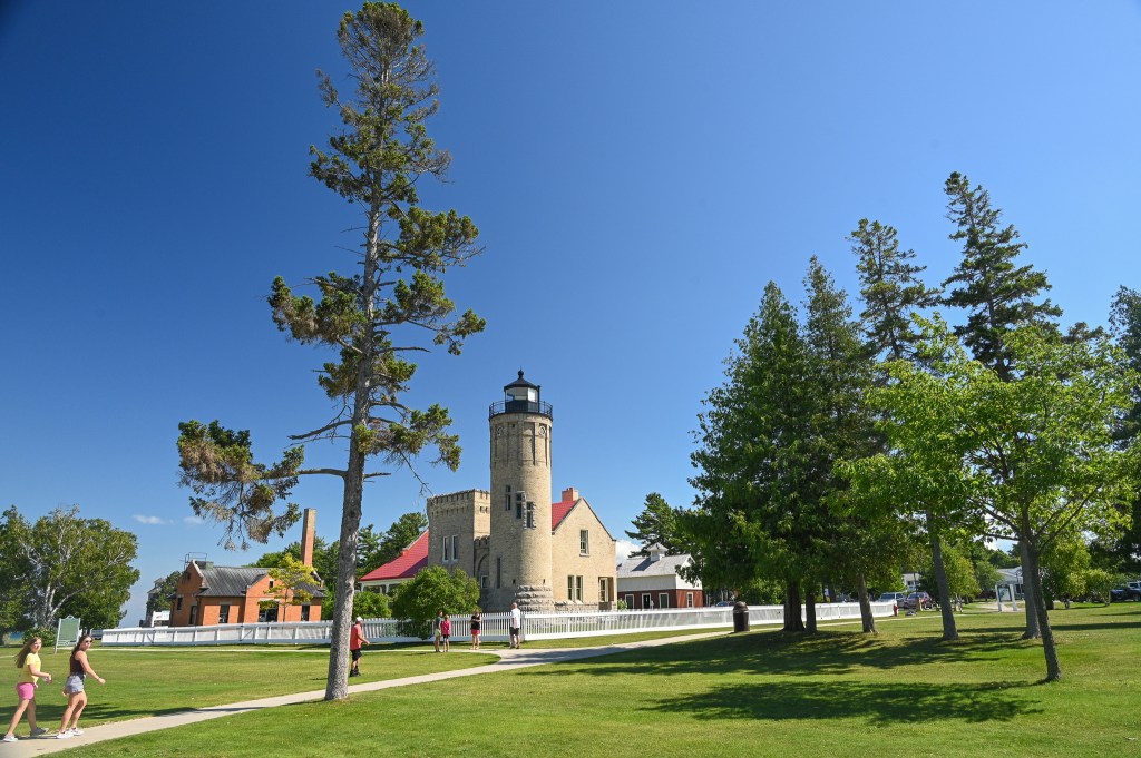
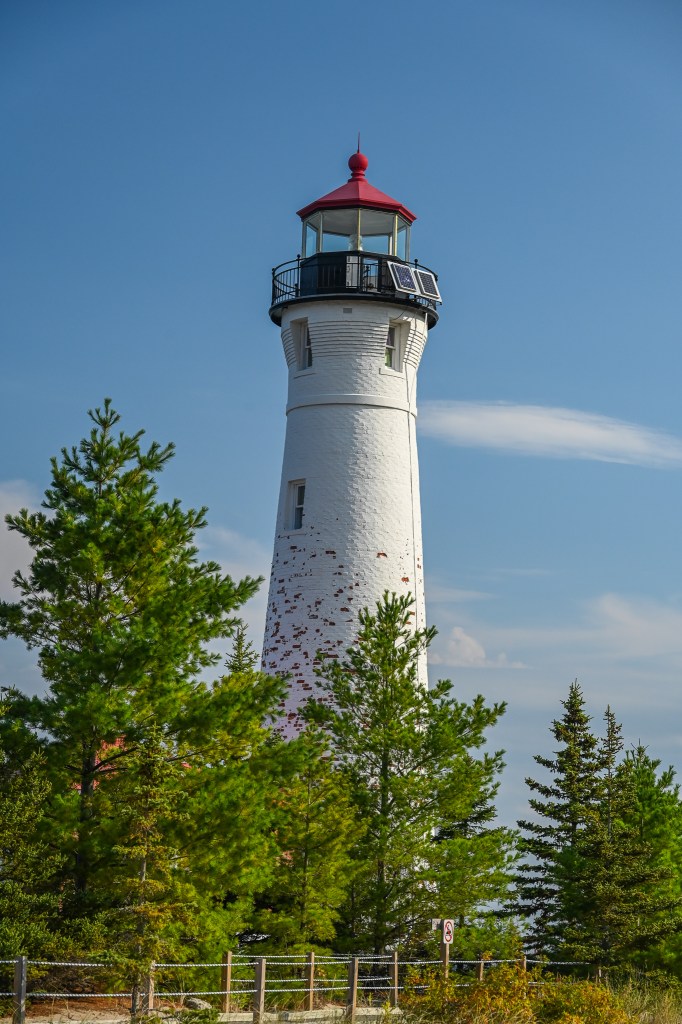
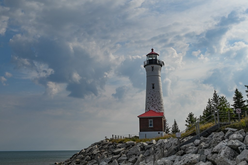
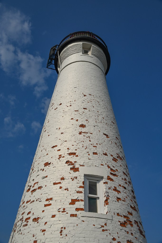
We visited one of them on our first full day in the UP. It’s a lighthouse that’s not easy to get to, and they tell you on their website and in their literature not to try to find it using GPS.

Trust me, they know what they’re talking about.

Only 6.5 more miles to go!

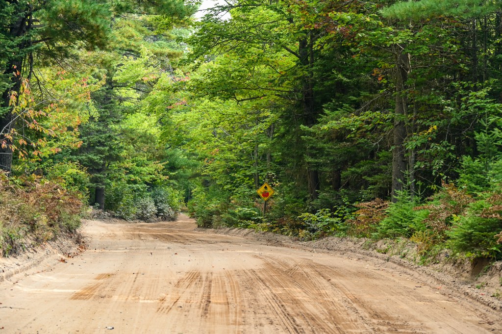
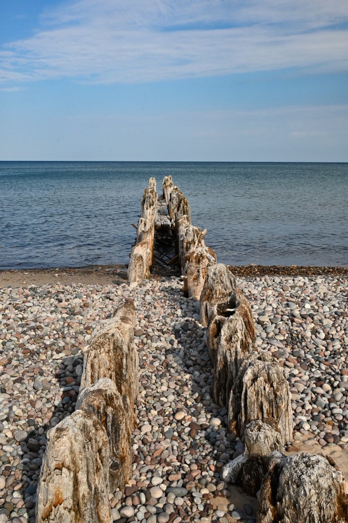
There’s no GPS or any kind of service out there, and you get dropped while you’re still miles away in the middle of the middle of nowhere. You need to follow sandy, sometimes two track roads. But the route is mostly well-marked (except for one very important corner where I had a 50/50 chance of guessing right but went left) so if you pay attention and follow the signs you will eventually get to Crisp Point Lighthouse.

Your first glimpse of Crisp Point Lighthouse makes you smile.

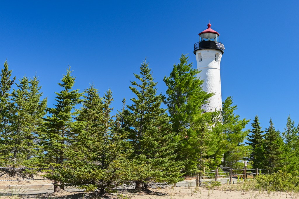
It’s definitely worth the multi-mile drive through the woods on roads filled with deep holes and standing water. Actually, the roads are one of the reasons I love it so. There are fewer people (but not NO people!) out there. You definitely won’t want to take your RV on those roads, and there’s nowhere to turn around, but if you have a car with a bit of clearance you’ll be fine.

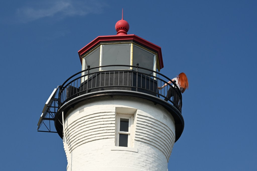
Anyway, once you’re finally there, and have breathed your sigh of relief, you’ll be able to climb the tower if volunteers are on duty to open it up. We were lucky and got to enjoy the view from the top.

From inside the tower you can see forever.

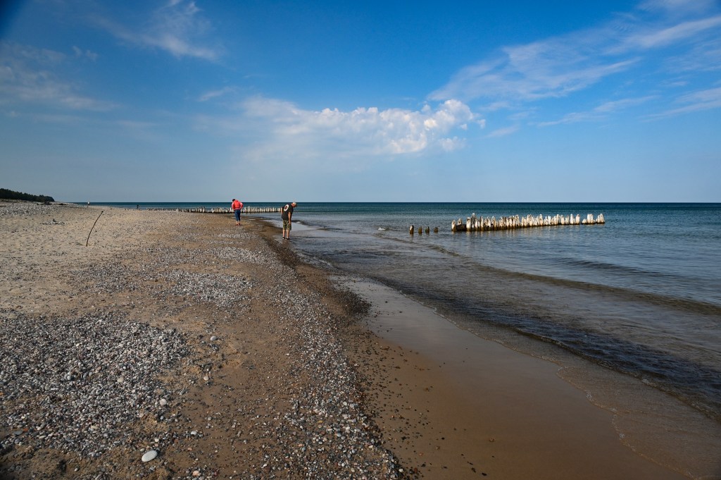
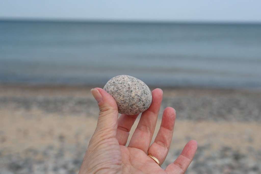
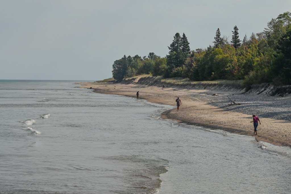
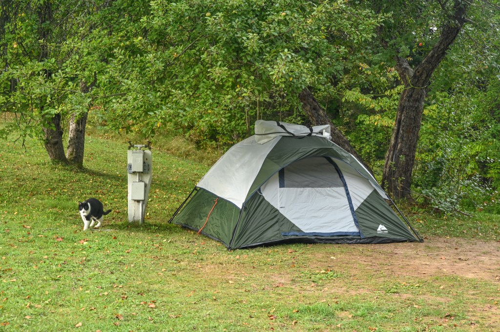
And then, since my friend is into rock picking, we walked the beach looking for perfect stones. Though to be honest they all looked like perfect stones to me.

Take your pick, you can’t go wrong!

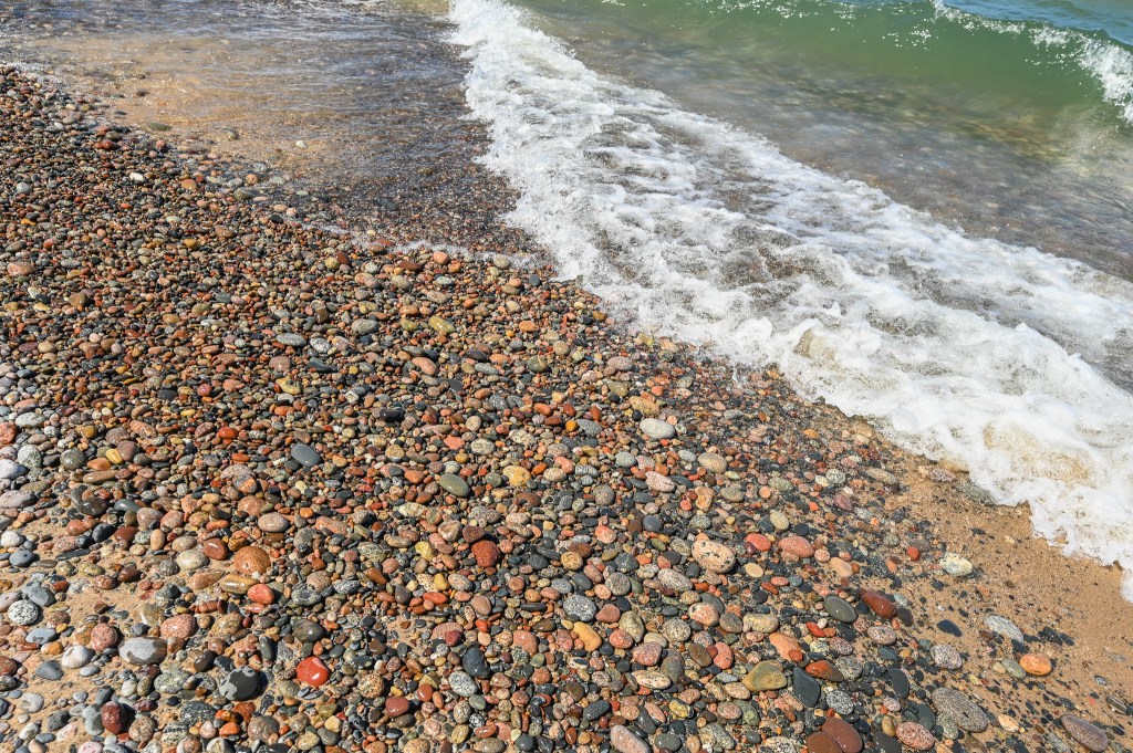
She’s a rock painter, someone who paints rocks with cute colors and pictures and than hides them for people, often kids, to find. It’s a thing. And I found out how fun it is to hide her painted stones as we left more than a dozen behind during the three days we were out exploring, tucked into crevices across the UP.

Wonder who found this painted turtle?

So I looked for smooth, white rocks that would be good for painting, and she looked for specific types of stones, like quartz (we both found some of that) and granite (lots of it!) and pudding stones (maybe!) and all sorts of others. I don’t remember most of it, but I was pretty good at finding smooth white stones.

Eventually we had to leave this perfect place and find our way back to the world of paved roads. We intended to spend the evening at Whitefish Point, several miles up the Lake Superior shoreline. Maybe there would be a sunset. Maybe there would be stars.

Waiting on the sun.

Maybe…just maybe we’d get to see the last super moon rise up from Lake Superior. And, of course, there’s a lighthouse there too.

An entirely different kind of lighthouse at Whitefish Point.

Well, it turns out there wasn’t much sunset, though it was still beautiful.

The cloudless sky turned orange and the most interesting part were the people watching it set.

And the moon obliterated most of the stars…so we didn’t stay real late, and we made it back to the hotel in Sault Ste. Marie shortly before midnight.

It was amazing.

Just in time to get a good night’s sleep in order to get up and do it all over again in the morning!

Do you see the hidden treasure?

Were should we go next?


19 Comments

And then…

My adventuring continues into the Upper Peninsualia of Michigan where I intended to spend a few days exploring the Seney Wildlife Refuge.

The refuge is a giant wetland, with lots of water and grasses.

Years ago when I lived in the UP I always thought I’d visit, but you know how it is when you live near somewhere cool. You always figure you can do it next week, and next week never comes around.

I couldn’t find an eagle’s nest

Late Sunday afternoon I drove the seven mile wildlife drive under pretty skies. I had the big lens on the camera, expecting to see lots of birds. But all I saw was a pair of sandhill cranes flying and a couple of ducks. I didn’t even hear much of anything.

I heard them before I saw them.

One issue I can see with driving a wildlife route rather than walking, is you’re never going to sneak up on anything. Though to be honest I didn’t even scare up anything.

These are the same two cranes that flew by.

But the trees and water were pretty, so I decided to switch lenses and just enjoy what there was to enjoy.

Light through dying ferns.

The refuge is beautiful, but I wondered what I’d do for four nights camping nearby. I decided to worry about that when I got there.

Meanwhile, I had a reservation at the Pleasant Moose Lodge for one night while I waited for my campsite to be available. I was tired by now, driving up from downstate, then exploring the refuge. I was ready to find the hotel.

But darn it, neither my GPS in the car nor on my phone could find this pleasant moose. I drove up and down the road looking, and saw plenty of places with moose art displayed, but all I saw whenever I was told “you have arrived at your destination,” was a decrepit rundown set of cabins. No way. It was getting on toward evening now and I was going to have to find somewhere to stay if these cabins were really the lodge!

Guess I didn’t notice this big green moose when I was driving by.

So I pulled into a parking lot called the Pleasant Moose and a pleasant guy answered the phone and talked me in.

Whew!

Imagine my relief when I saw it was a real hotel, just tucked way back behind some other stuff. I spent an uneventful evening, enjoying my last night of a real bed, shower and television before heading out to camp for 4 nights.

The next morning I needed to find something to do while I waited to check into my campground. I remembered seeing pictures of Crisp Point Lighthouse that was somewhere around here. Checking the map, and putting it into my GPS I set off. It was about 20+ miles away, but GPS said it would take me an hour.

The trees are beginning to turn up here.

What GPS didn’t tell me is that more than 15 miles of the trip will be on increasingly narrower dirt and sandy roads.

More narrow, and sandier.

Roads that wind up and down and around. My average speed on the last 15 miles was 14. The last 7 miles it was closesr to 8 mph. I couldn’t believe it when, with only 5 more miles to go there was actually a stop sign.

Seriously? Is there an intersection coming up?

But all that crazy driving was worth it to find this.

My first glimpse of Crisp Point Lighthouse.

The lighthouse is absoutely beautiful. And yes you can go up to the top for a donation.

As I wandered the beach the clouds moved in.

The beach is equally beautiful.

Nobody can resist these rocks!

It’s strewn with wide swaths of smooth, rounded stones. A rock picker’s paradise.

The water was too cold to go wading after these beauties.

I kept telling myself not to pick up any rocks. Not to even look closely at any rocks. I have plenty at home.

I had to touch. They were so smooth, this one reminded me of an granite egg.

But they were soooo beautiful!

I was also facinated by what I guess was an old wooden breakwall.

I love how the sun made it glow.

It was actually two rows of logs driven into the ground.

Engineering from a generation ago.

Eventually I walked back up to the lighthouse and checked out what was on the other side. The light was better over there anyway.

People were picking rocks….

The beach was sandier with fewer rocks on that side.

…and climbing the tower.

A lighthouse selfie.

It was beautiful out there! But it was time to head back down that winding, sandy road.

Quintessential beach photo.

The trip back out to the main road wasn’t nearly as scary as it had been driving in.

I enjoyed the leaves on my way back and didn’t worry about the road as much.

My campsite was waiting for me.

When I arrived the office was closed, but they had taped instructions for me to the door. I gathered those and drove to my site, a big, grassy relatively flat spot with a view of the river. I pulled the tent out of the car and realized as I was unfolding it that the rainfly was missing. And it was beginning to rain.

OH MY! What to do.

Obviously I couldn’t tent without a rainfly. Especially since it was already raining. Disgusted I threw the tent back in the car, went up to the office, put the rest of my reservation money folded into their instructions, along with an explantion note, and taped it to the door.

Then I drove back toward town, intent on calling the Pleasant Moose to see if they had a room. But a few miles away I thought I should call the campground and tell them there was money taped to their office door, wanting to make sure they got it rather than some nefarious camper.

The owner answered, and I explained and she was as sad as I was. Then she said she had a tent I could borrower! Really! Yes, she said, it’s just a 4 person tent, nothing fancy. That’s all I had myself, I replied. She said she’d go set it up on my site if I’d come back.

So I did. And this is what I found:

Isn’t this cute?

This campground comes with a mascot.

He waited around to make sure I was OK, then he went off on his rounds.

So….here I am camping in the UP in someone else’s tent, ready to visit a refuge I’ve already explored.

What will happen next?