I’ve been out of town for most of the last week. I, of course, took lots of images. But the main reason for the trip was to experience dark skies in South Dakota.
I’m lucky enough to have a friend from high school who lives on a farm away from city lights. For years we’ve talked about me going out there to see the stars.
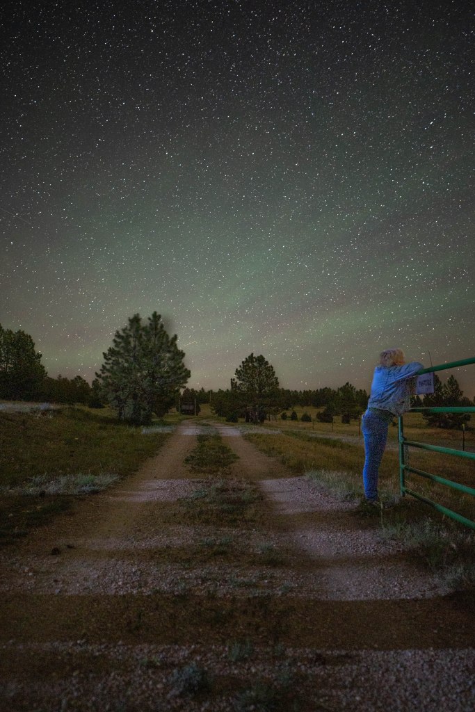
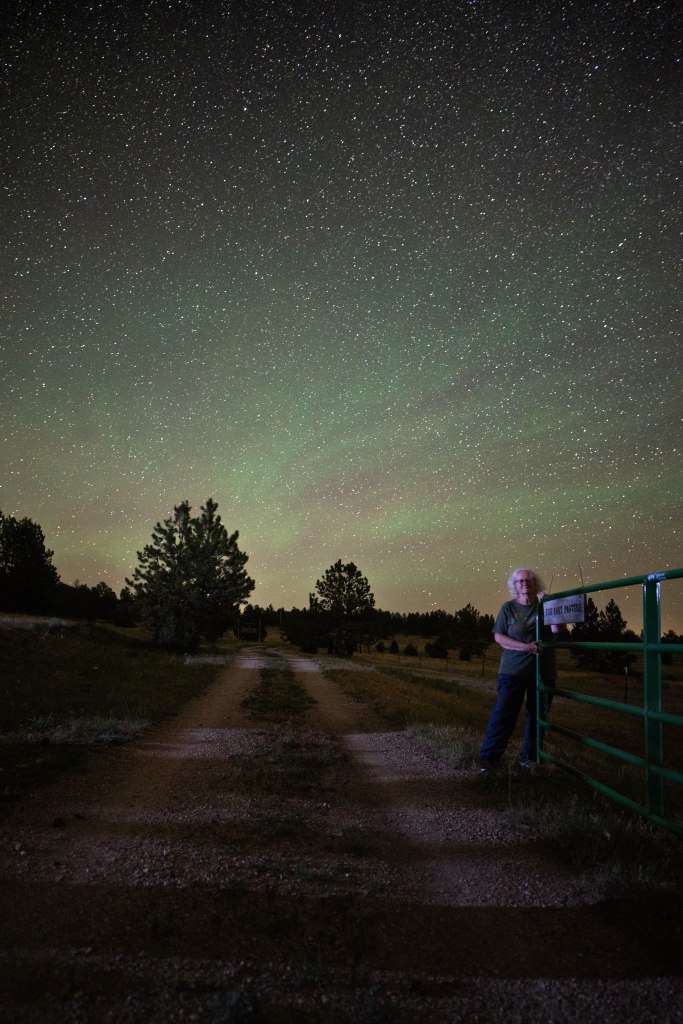
My sister contemplating life on the prairie.
So last week it finally came together and my sister and I drove out there. We were so lucky that the skies were clear for all three nights that we were there. We spent a few hours each of two nights staring up at the sky with warm breezes keeping the bugs at bay.
I have 3 sets of night images to process, the barn, a tractor and the gate. But I need to learn how to stitch skies and foregrounds together in Photoshop. The learning of that will likely take me awhile.
Me telling letting her push the shutter.
For now I’ll share these single take images of my sister and me. When I learn how to process the rest of them I’ll share those as well.
We had a great time and want to thank our hosts so much for sharing their lives and their skies with us!
(PS: WordPress makes everything darker. I’ve used the lighter of my images but if it’s still dark, try looking at these in a darkened room on a bigger than your phone screen.)
Hey! It’s official! It’s time to stand up, step out, get going, and plan your walk or drive or skip or hop or swim or jog for this year’s Walktober!
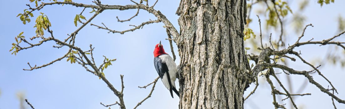
These guys get overlooked all the time.
Take us somewhere that you love to go, or somewhere you’ve never been before. Tell us (and show us with pictures if you can) about it and why you’re happy you went, or why you’re disappointed in your chosen place. Do you think we should stop and visit it if we’re ever in the neighborhood?
Solo sunbathing.
Tell us all your hopes and dreams. OK…maybe that’s too much information, but tell us about your adventure, where it is and what it’s like, and then link it to this post.
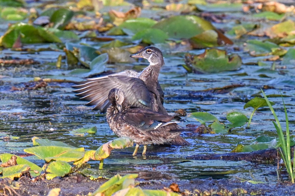
Wood ducks
Early in November I’ll assemble a post with links to all of your posts, and then everyone can come along on your walk, hop, jump, skip…well….you get the idea.
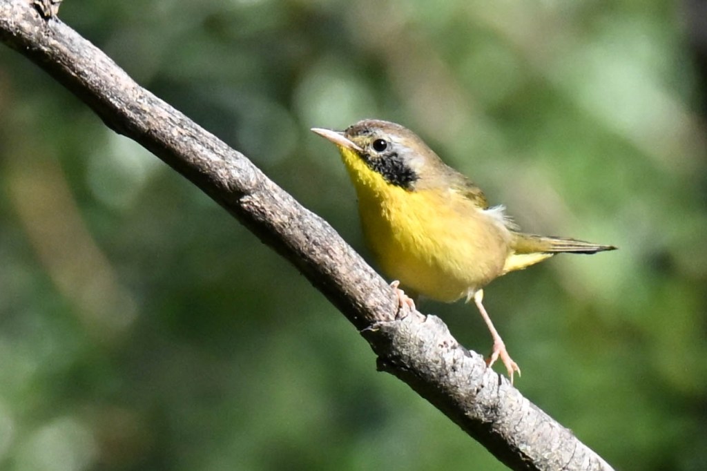
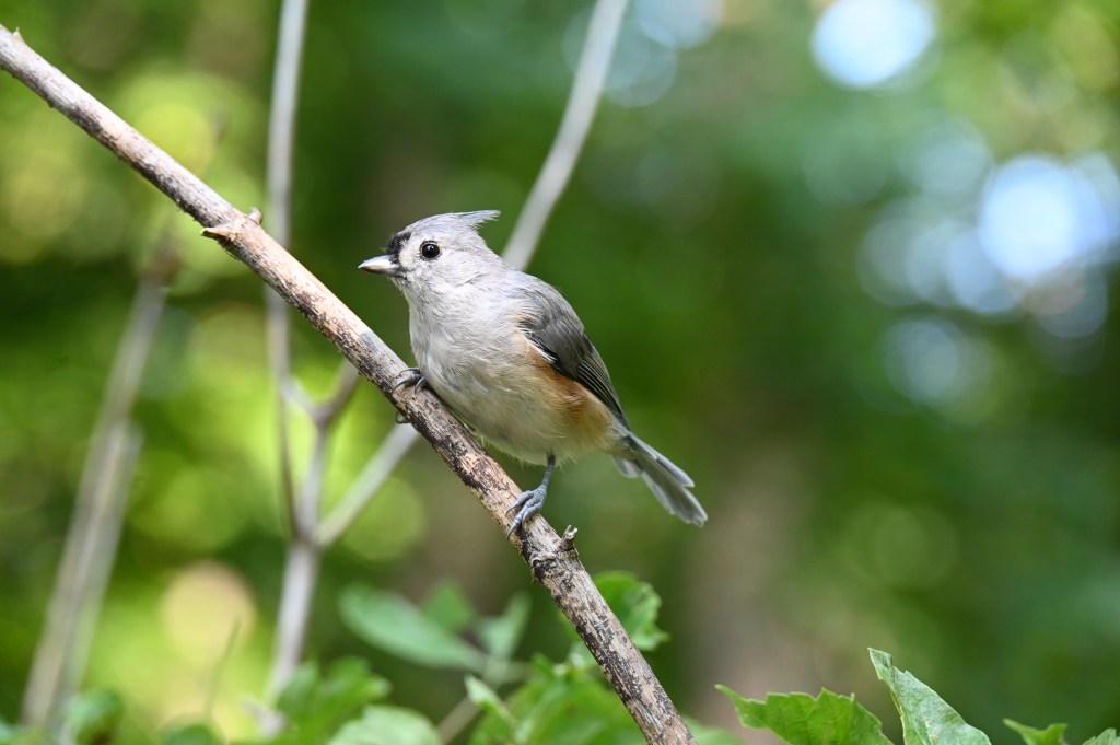
Common yellowthroat. I waited a long time for him to come pose for me.
So let’s set the official Walktober dates, OK? Because if you’re like me you’ll let it go until the last minute or you’ll forget about it all together if there aren’t specific dates. Right? Right!
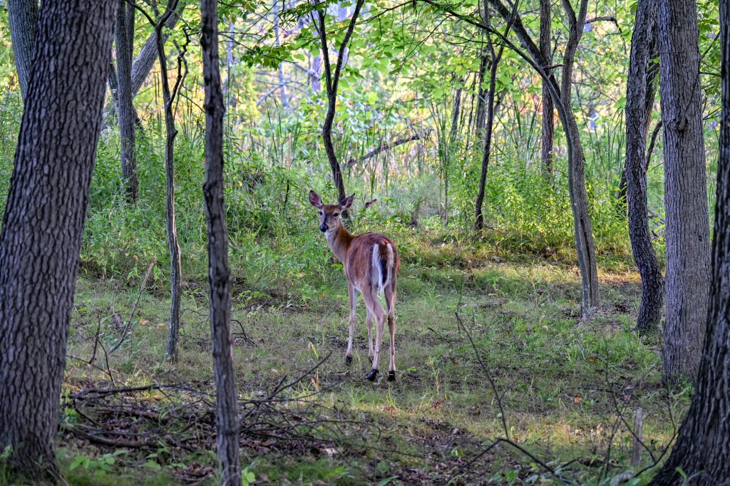
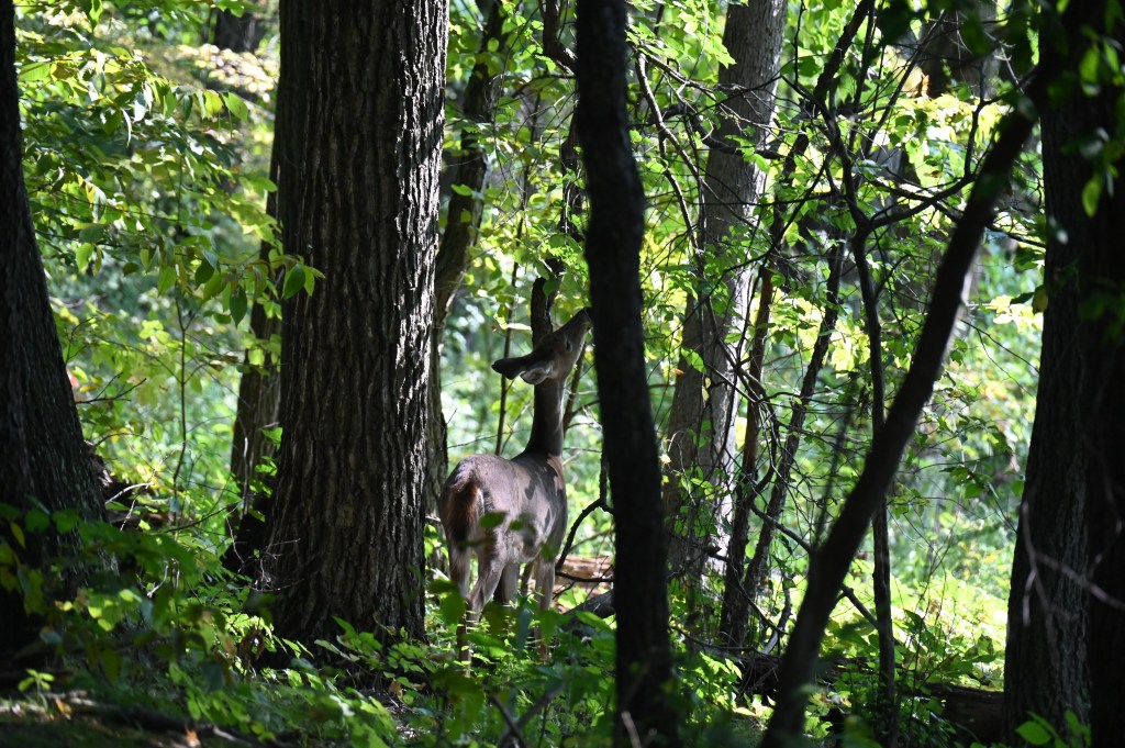
Mama deer taking a break from parenting. Her youngster is to the left behind the trees.
So how about our official Walktober kick off on October 1 (who will be our first entry?) and end by October 31? That gives us the entiremonth of October to get outside and enjoy ourselves. I hope you all have at least one perfect day.
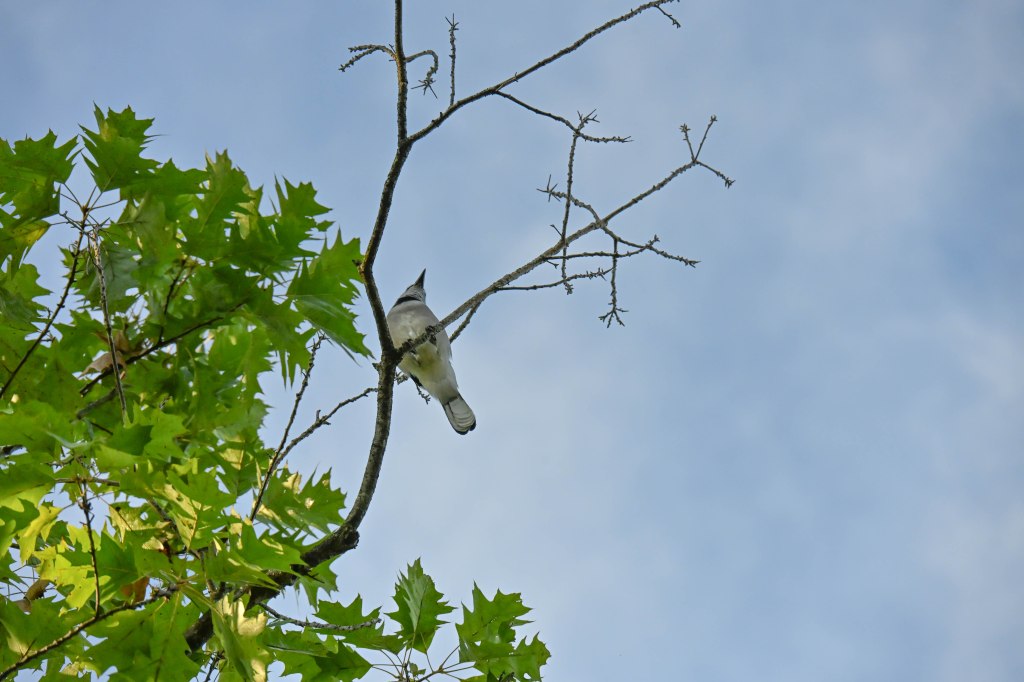
A bluejay lets his friends know about the treats down below.
I have a concert to play on the 28th, and dog rally trials on the 24th and 31st, so I’m really busy at the end of the month. I better not wait to get my Walktober done!
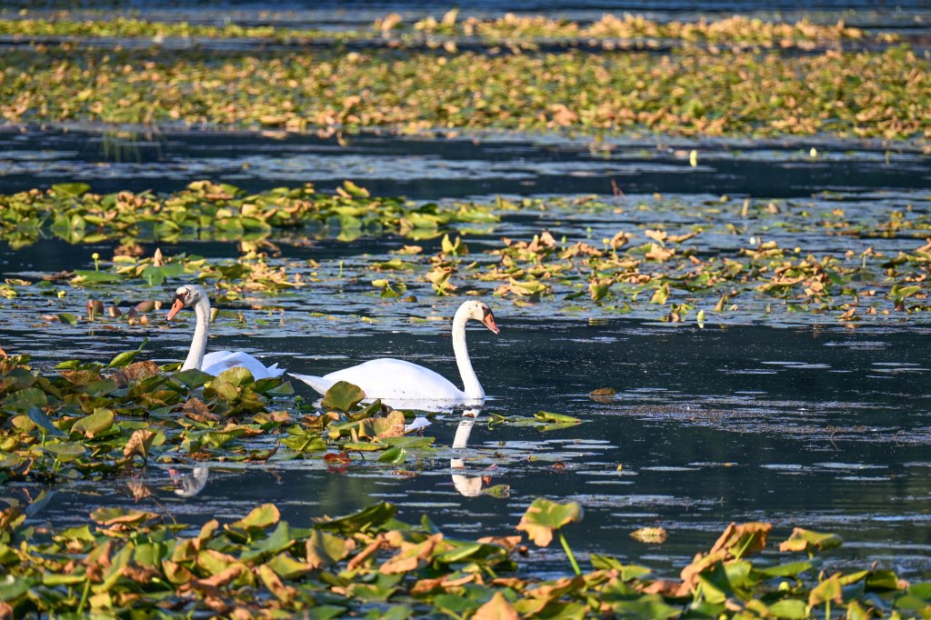
Swans in morning light.
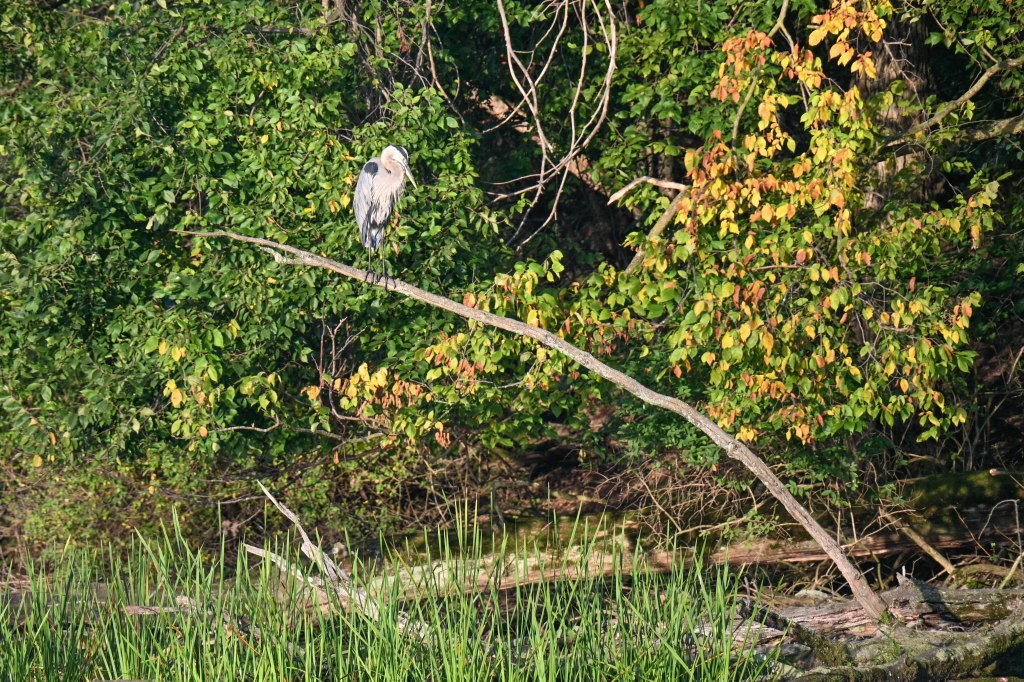
The pictures in this post, except the last one, are all from a walk I took a few weeks ago at my favorite bird park, Kensington, with an updated Nikon camera, focus set to latch onto birds eyes.I was pretty happy with it.
You just know he’s going for the peanut.
If you have questions about Walktober let me know. I’ll get back to you as quick as I can.
Meanwhile, Ms. Penny is giving serious consideration to where she would like to take you for her version of Walktober. She invites any other dogs (or cats or birds or lizards!) to go on a walk and tell us all about it too. She thinks hopping or skipping would be too hard and she doesn’t have a drivers license.
She says it’s not that difficult to hyjack your mom or dad’s blog.
This is one option, mom, but I’d like to take the folks somewhere more exotic.
She does it all the time. She says parents are so gullible.
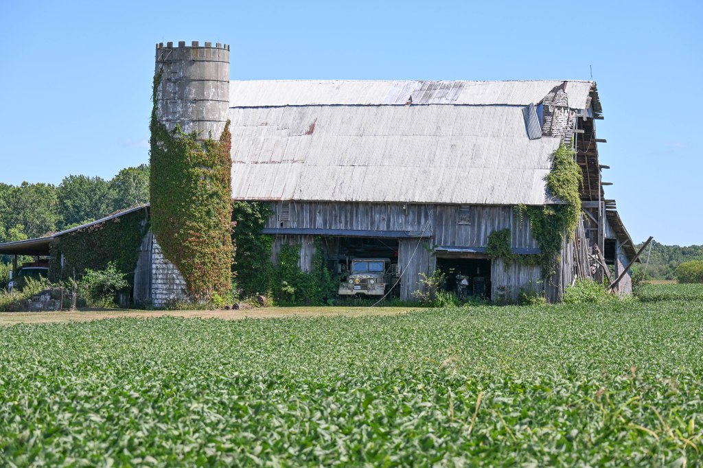
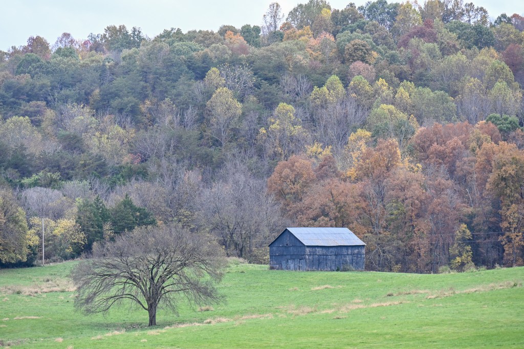
I just don’t think it’s possible for me to travel cross country and not stop for a barn photo opportunity.
Even if it’s a drive I’ve made many times before there always seems to be something that looks pretty enough to warrent a detour from the freeway.
The question is, always, is there an exit nearby and can I find my way back to that beautiful barn without spending too much time searching?
And, once I get back there, will there be a place that’s safe for me to stop and snap a quick shot?
In reality I see many amazing farms while traveling on big interstates and they’re often not possible to find again. Usually there are miles and miles of interstate before the next exit, and no obvious roads back to what I saw.
But I remember them, and they make me smile, so even though I don’t get to keep them forever in my files, I get to enjoy them for a brief moment.
And that counts for someting too.
***Don’t forget to be thinking about where you’d like to take us on your version of our annual Walktober! Take a walk, or ride a bike, or hop, skip or run and take a few pictures to share with us. Post about it and link your post to my Official Walktober post (which I haven’t written yet but I will very soon!) and at the end of October, or maybe in early November, I’ll put them all together in one giant post for everyone to enjoy.***
On my way down Lookout Mountain I saw this. Of course I had to turn around and spend some time in awe.
As some of you have figured out I’m away from home. I took an opportunity to spend a few days with family down in Alabama.
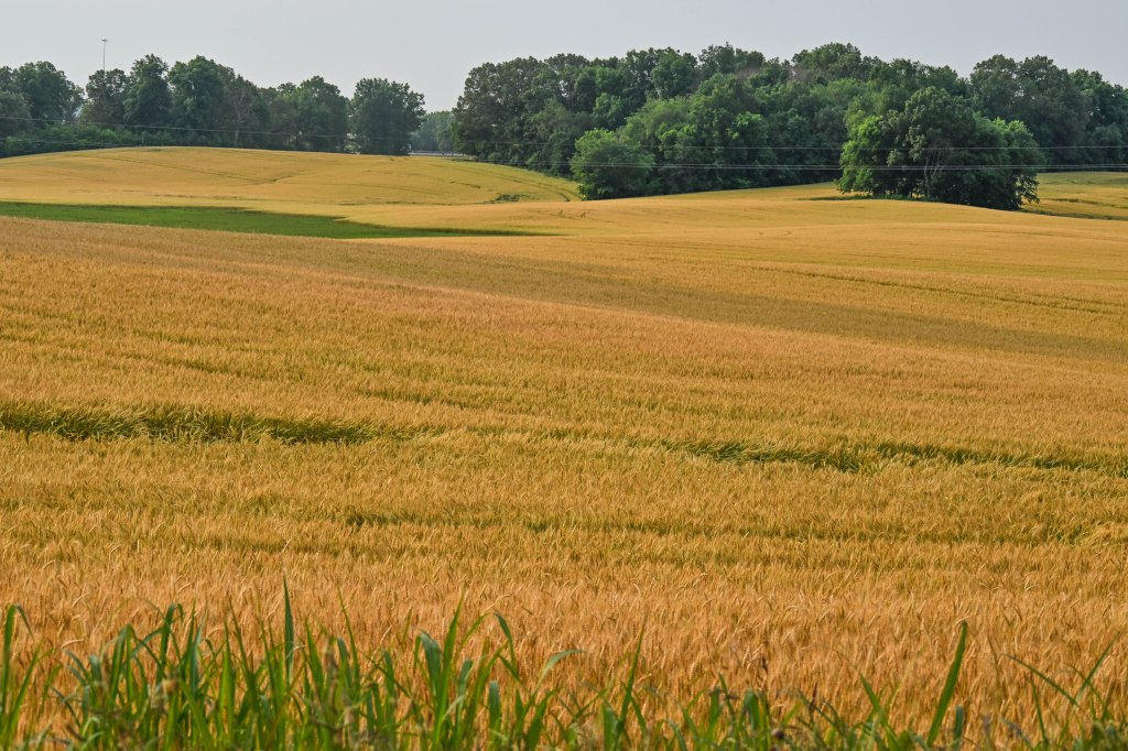
I couldn’t resist stopping when the wheat was golden in the morning light.
And though I could have flown and made the trip South faster, I chose to drive, because I love to drive and I enjoy seeing whatever there is to see along the way.
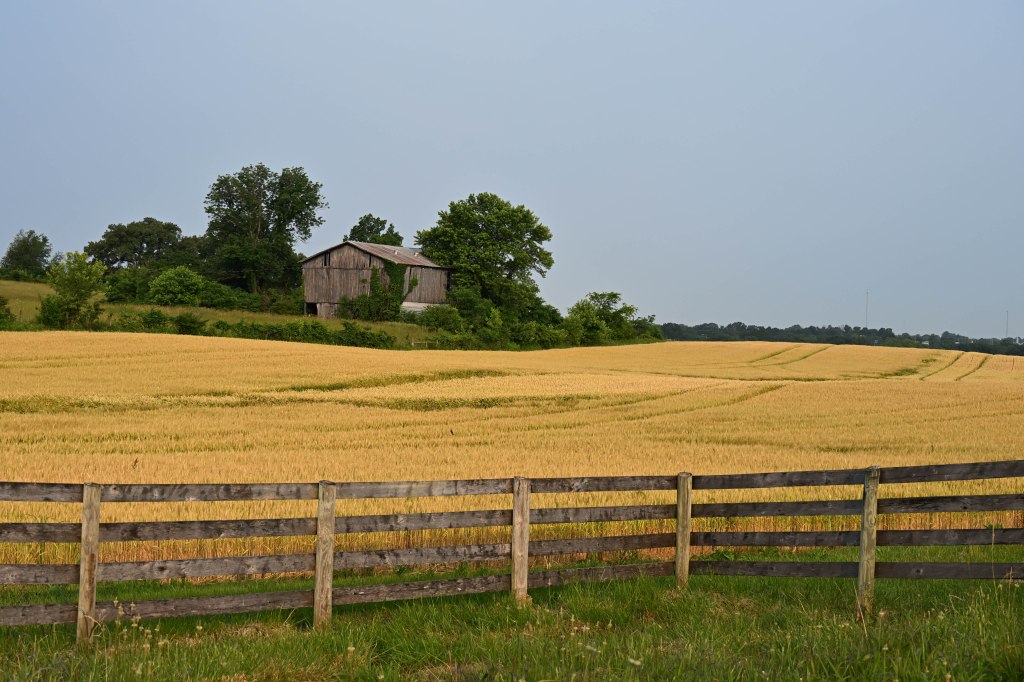
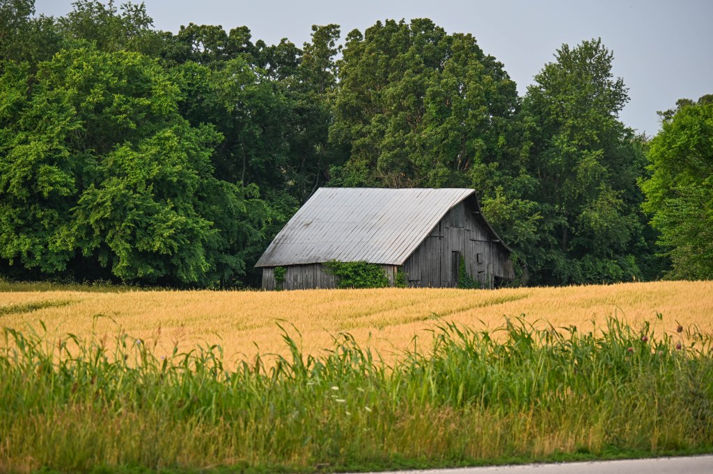
And to find a wheat field AND a barn…well….of course I stopped!
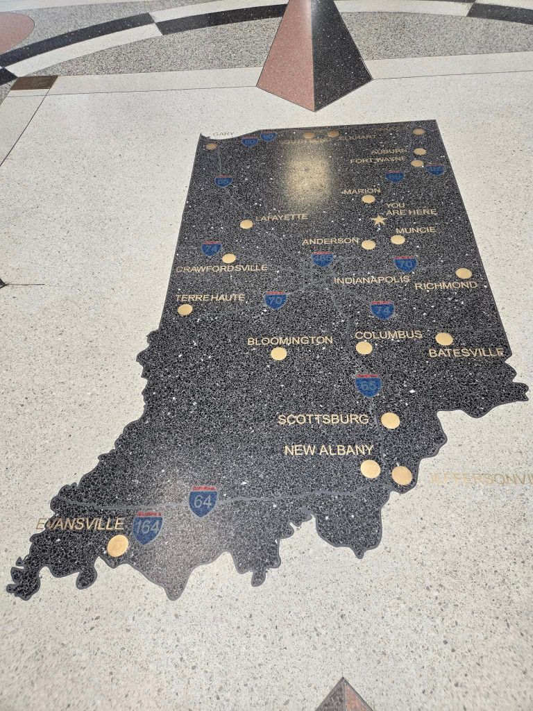
This trip went easier than my last trip in November. The road didn’t seem so long, nor the traffic so busy. Not to say there weren’t the normal amounts of stress getting through Indianapolis and Nashville and especially Birmingham Alabama.
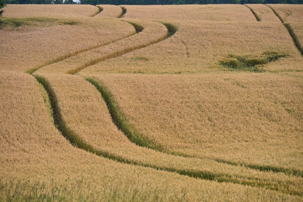
I appreciated the art of a farmer’s tracks through rolling fields of grain.
But Sunday morning as I left my hotel in Bowling Green Kentucky I noticed the wheat fields were ripening and the early light was making them glow.
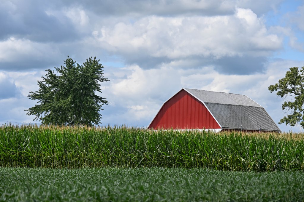
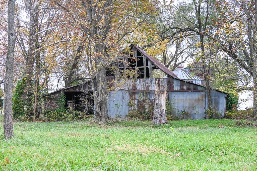
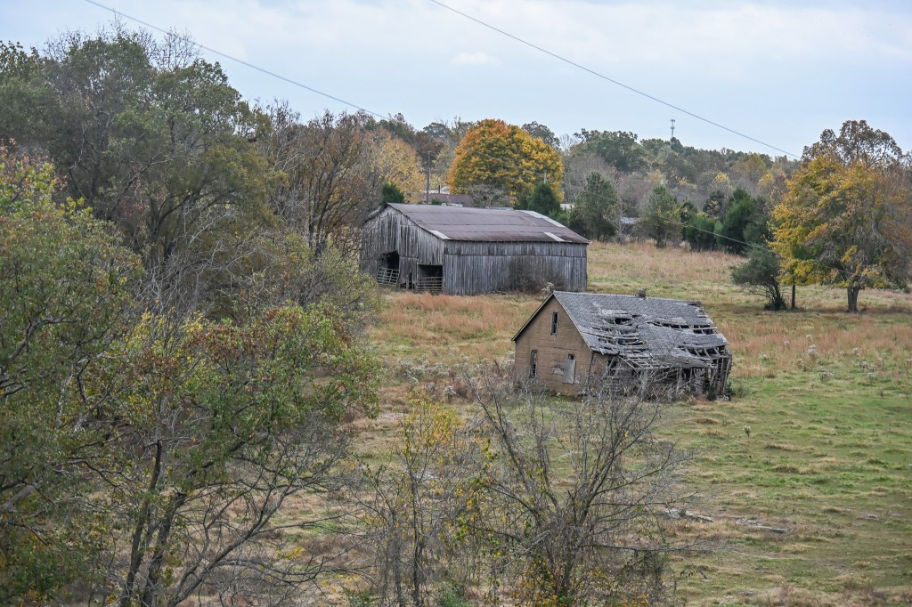
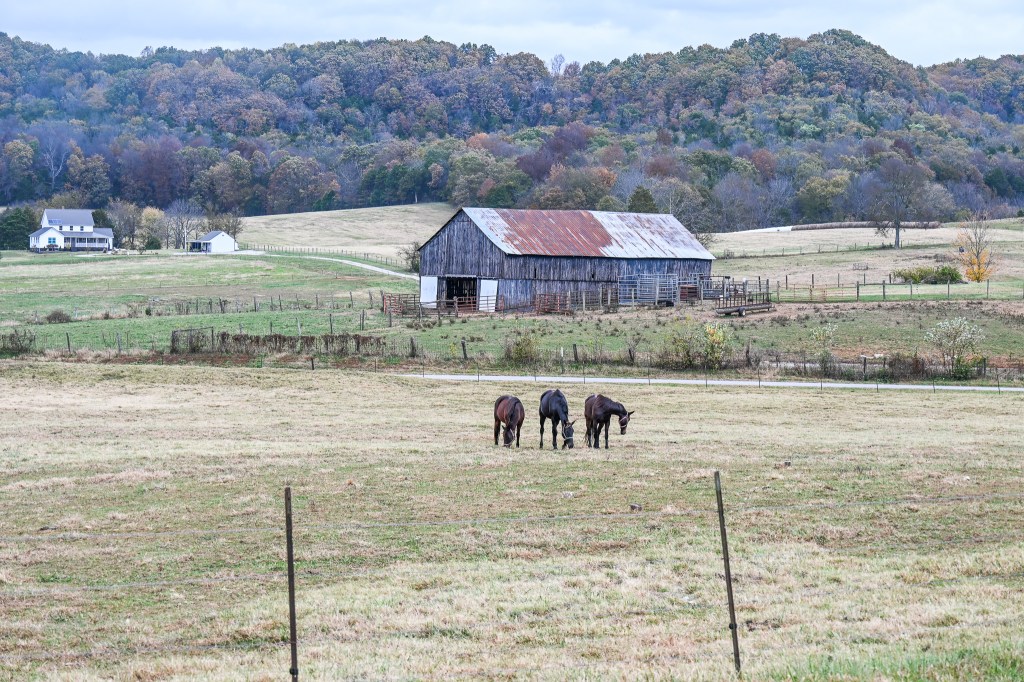
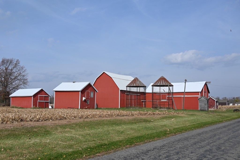
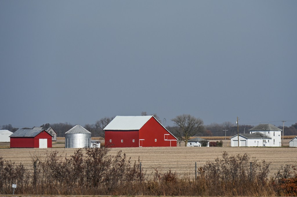
I’m just a sucker for an old barn.
All day Saturday I hadn’t stopped for a single photo. I even managed to resist the exit I’ve been lured into by photogenic barns the last three times I’ve driven down.
I went around a big country block to get this one.
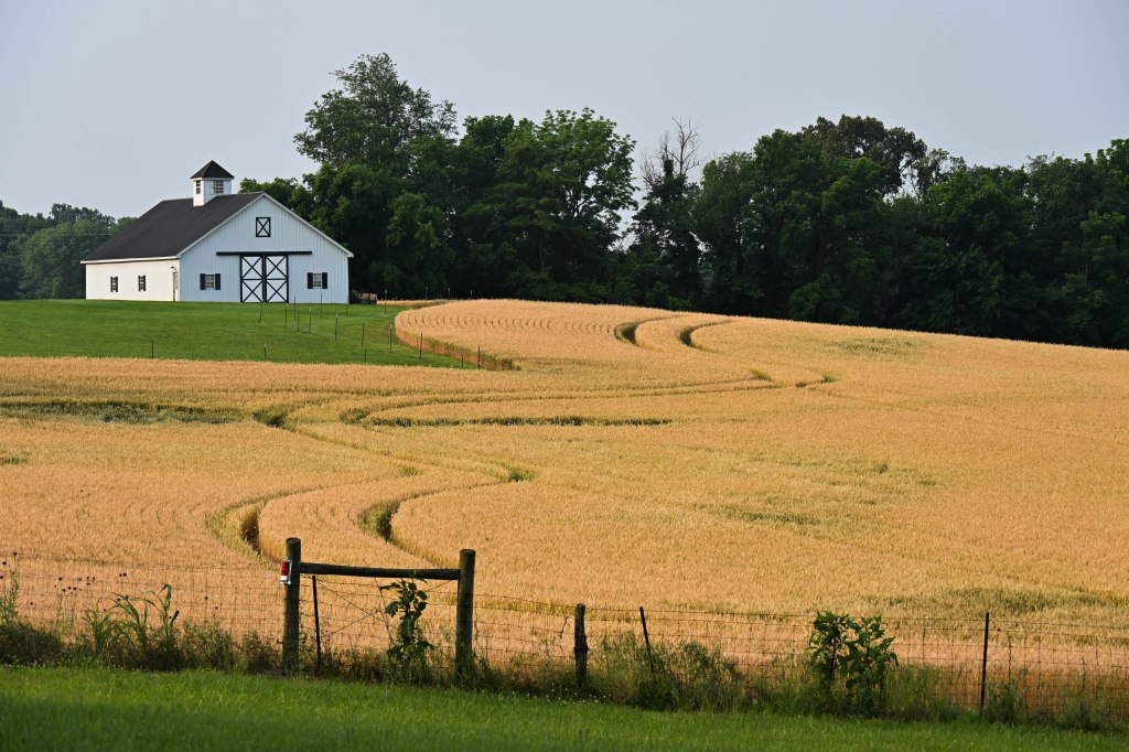
So I thought it was only fair that I take thirty minutes and find a barn or two in wheat fields.
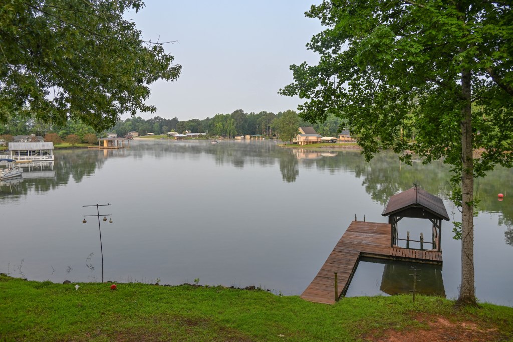
Eventually, last Sunday, I made it here to one of my happy places.
I’ve been down at the lake for a couple of days now, but for all you barn lovers I’ll do a short post from my second day of driving south.
I saw a promising area, with rolling hills and what seemed like a lot of barns somewhere in Kentucky off of I 65. I pulled off at the exit and turned onto what looked like a service drive to head back and look for the barns.
Even as turned I began to feel faint bits of recognition. It felt like I’d been down this road before.
Then I started thinking, ‘if the road curves sharply to the left and then goes up a hill I’ve definitely been here before.
And it did.
Even funnier is that I think this is the third time I’ve been down this road, each time on the way to Alabama, and each time enticed by beautiful barns visible from the freeway.
This year, not having a dog with me, I went further down the road and found some ‘new’ barns — structures I hadn’t seen before.
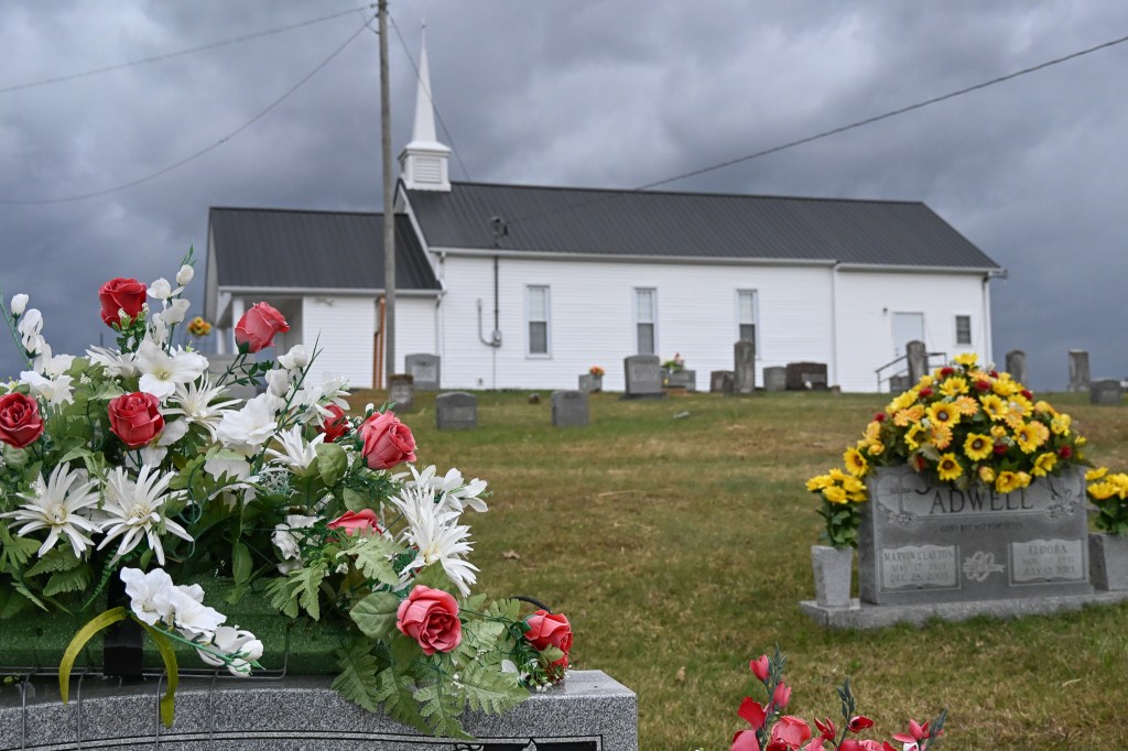
And as the sky darkened with an oncoming storm, I saw in the distance a white church spire that I had to go find. So I did.
I wandered around the cemetery a bit, and shot some barns off in the distance. Then I high tailed it back to the freeway for the rest of my trip home.
I’m going to try very very hard next time I’m driving down to Alabama not to be seduced by this road and it’s barns again. I think three times is plenty.
Has anybody seen my mom? I can’t find her and she’s been missing for at least 3 days. Maybe more!
I’ve looked and looked in all her favorite places. You know, like in her bed, and on her sofa, and in her favorite chair and at the dinner table.
Maybe she’s lost in one of my parks! I’d drive over there to look but I don’t have a driver’s license!
I asked my dad, and he said not to worry, he says mom is fine, she’s just taking some “Penny-free time” for herself.
Penny-free?!?!?!
What the heck does that even mean?
Anyway dad said to tell you all not to worry, and that mom will get that Walktober collection post done as soon as she gets home. I figured you guys would want to know.
Meanwhile I’m going to sleep in her bed next to my dad every night. Maybe if I make her jealous she’ll come home to us.
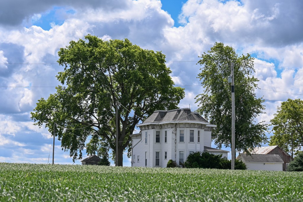
I’m headed for a short visit with family down in Alabama. Which means I’m driving through farm land. Lots and lots of farm land. I’m beginning to think you could throw a dart at a map of the US Midwest and there’d be a great barn to photograph right there.
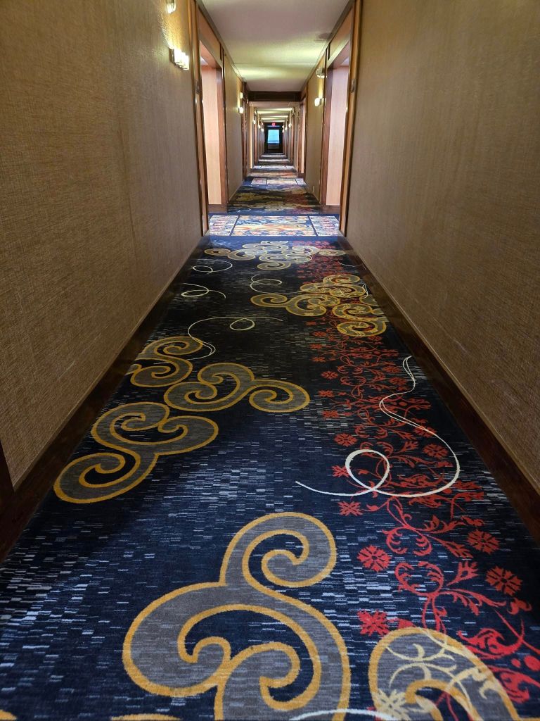
A rest stop floor.
Yep, everywhere I look I think, “I need to come back here, find a campground, and spend a couple days hunting barns.” Sort of like looking for places to shoot the Milky Way, but I’d get to be out with the camera in the daylight instead of tromping around in the dark.
Yesterday’s hotel carpet.
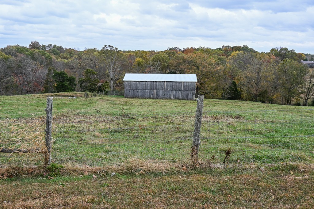
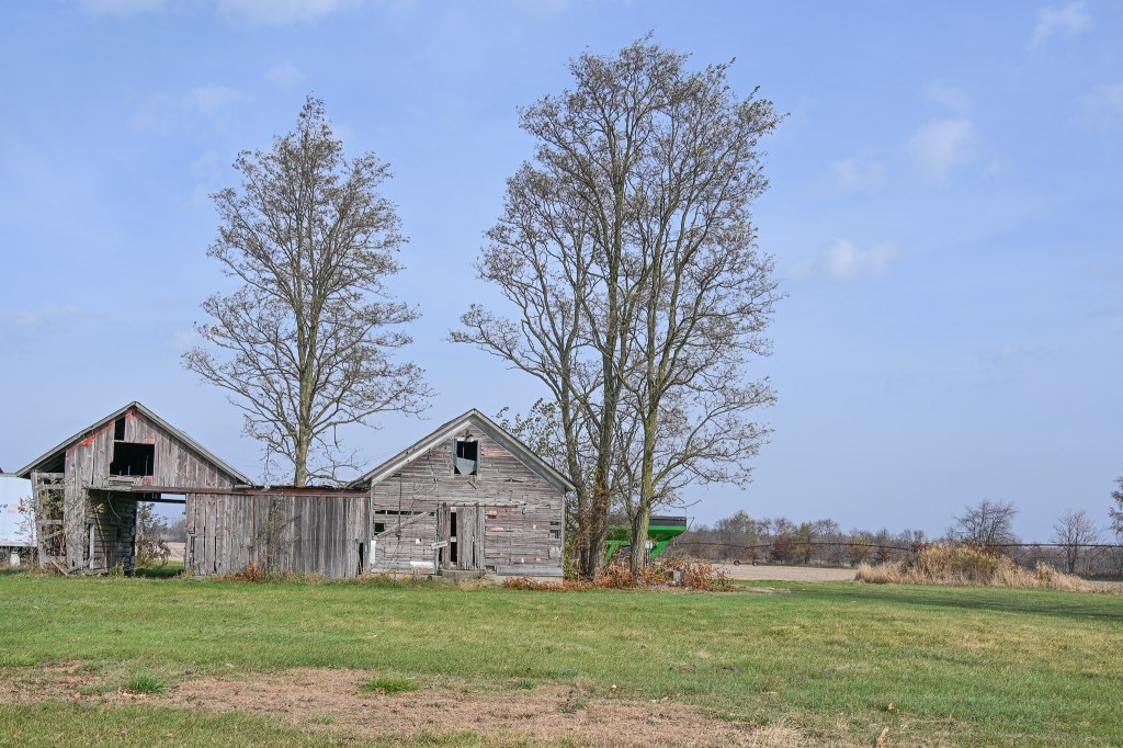
Just before I crossed from Michigan into Indiana I saw a barn out of the corner of my eye…and since there was an exit right there I took it.
These aren’t the barns I saw from the freeway, but they made me smile.
I never did find my way back to the barn that caught my attention, but I found this one.
Not the one I was looking for, but it is beautiful.
I thought it was beautiful, the white of the barn and the gold of the tree.
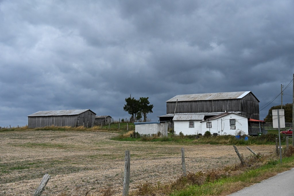
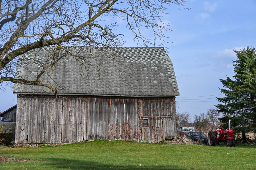
And, while going around the country block to find my way back to the freeway I found this one…
More a corn crib and a shed than a barn.
….and this one.
Used to match the tractor, I’m sure.
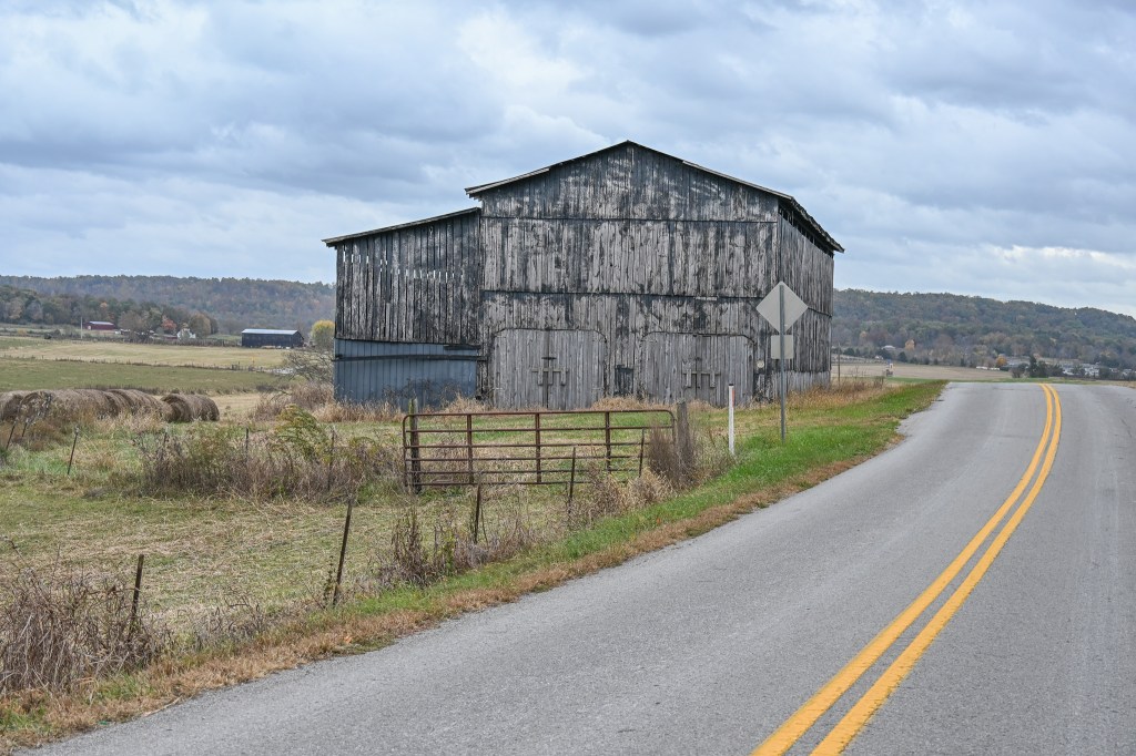
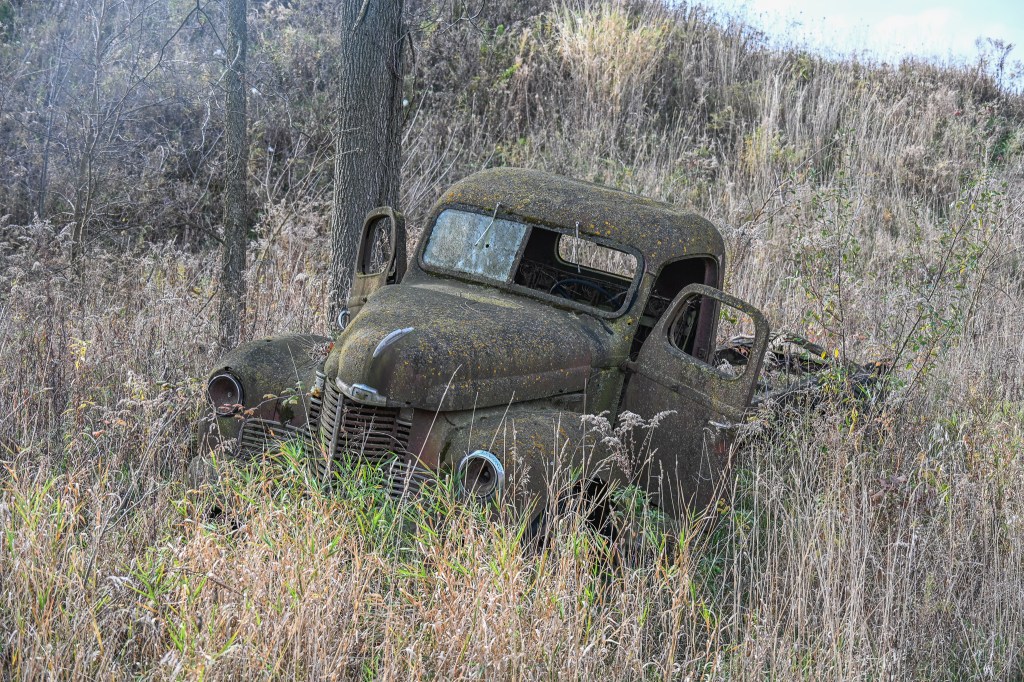
AND, my best find on that little side trip was this:
Just sitting in a field near the road.
I LOVE it. Old trucks rank right up there with old barns in my book.
And just so you can enjoy a little more fall color, this was at the last rest stop before I stopped for the night near Louisville KY.
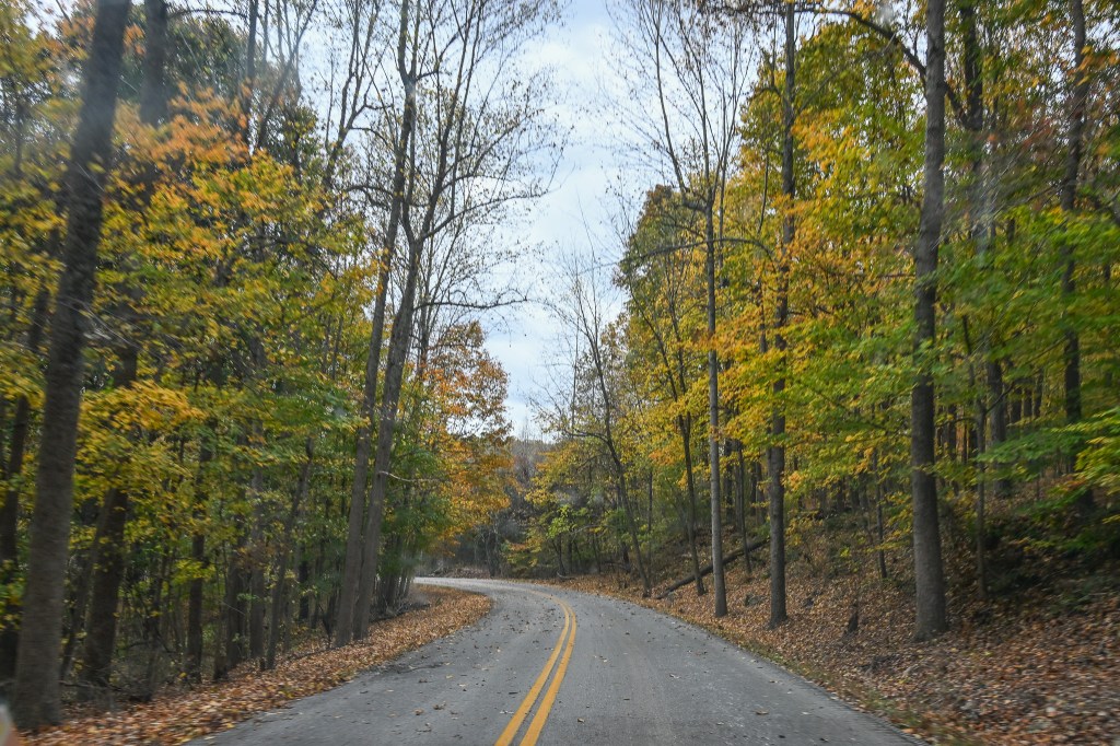
There’s still lots of color down here.
Tomorrow I hope to get all the way to the lake. We’ll see. It will depend on whether I take any more barn hunting side trips.
What are the odds I make it all the way without straying?
How many of you know what a Walktober is? Not everybody? Let me take a moment and explain.
Many years ago Robin, over at her blog, Breezes at Dawn, introduced me and others to the idea of taking a walk in October, blogging about it and then linking our posts back to her blog.
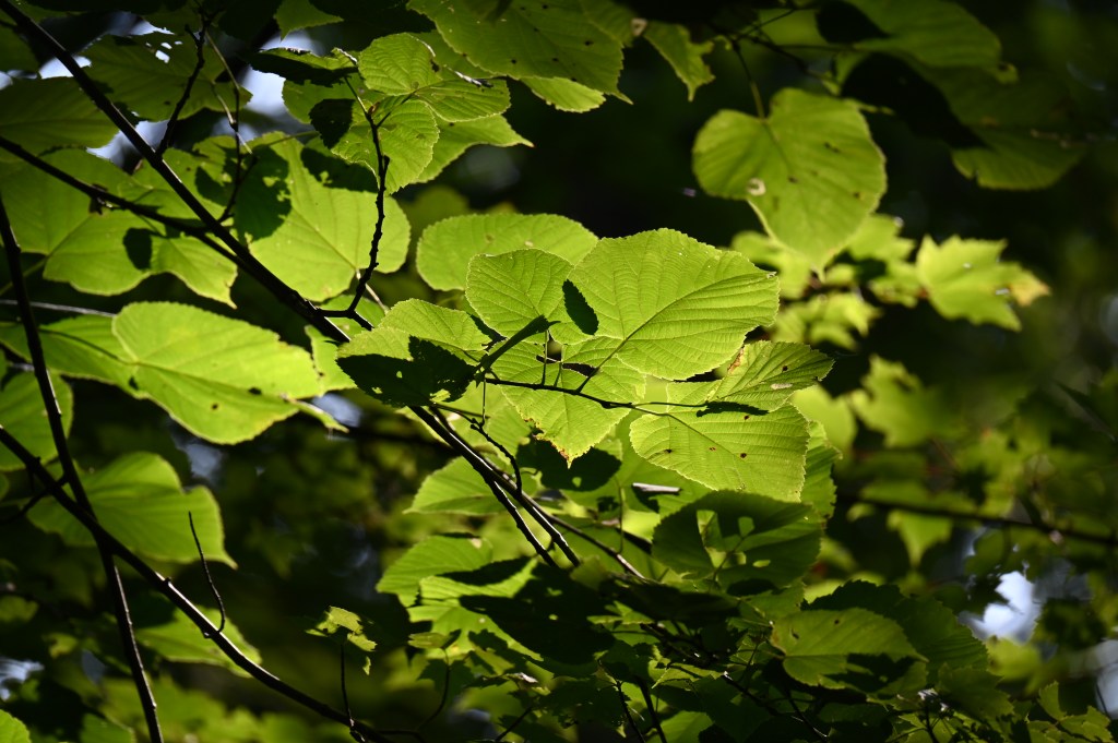
Fall colors aren’t all up in the trees.
People walked from all over the USA, Canada, and from the rest of the world too! She’d collect all our stories and then at an appointed time, perhaps early November, would post on her blog a roundup of sorts, a collection of all our posts, where everyone could read about all the walks.
A little chickadee ventures in for a snack.
Robin coordinated this event for years and then last year she needed some support as she was busy with other things, so I did the collection and roundup part.
I think this year there is another person scheduled for this role, but I’m not sure. I’m going to try to find out.
Light is different in the fall too.
But regardless, I think we can put a successful Walktober together, even if there is no one else able to coordinate the effort. I can always do it again, no problem at all.
Sooo….would you like to go on a walk and show us your part of the world?
As Robin always says, it doesn’t have to be an actual walk. You can go for a jog or a bike ride. You might travel in a car or a train or a subway. Maybe you’ll want to hop, skip or jump your way around. Any way you want to do it is good, just show us your world!
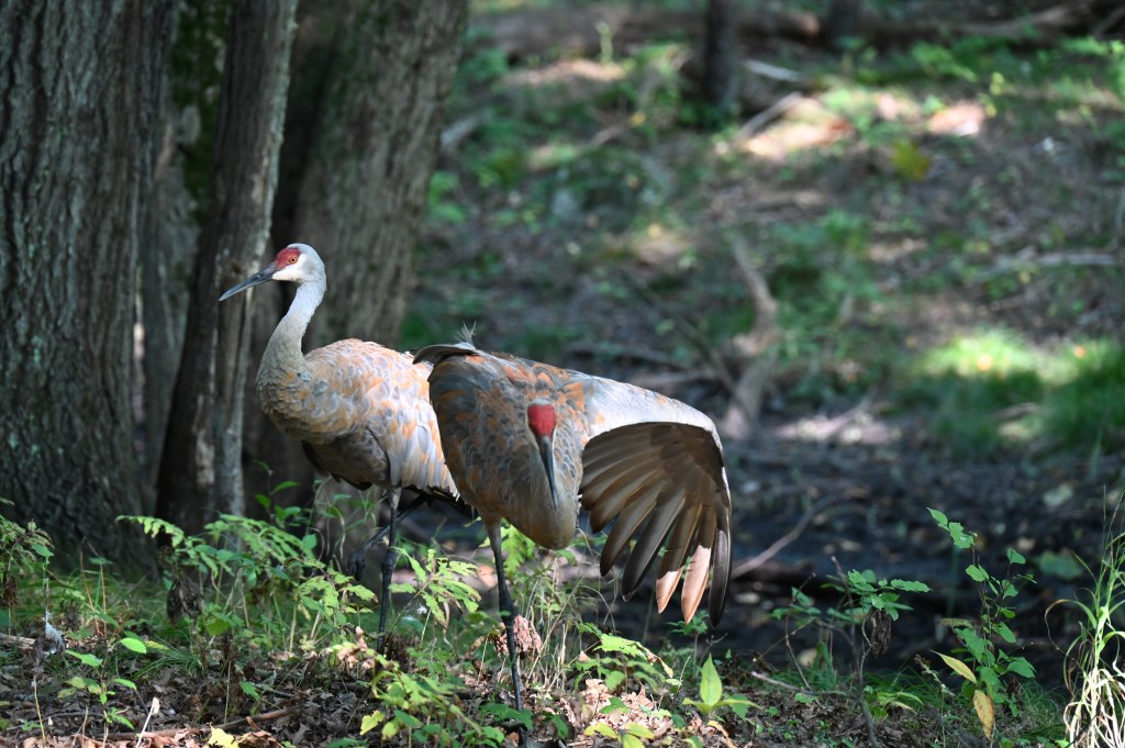
Two cranes preening when one needed to take a biggggg stretch.
Lots of people choose to take their walk in the woods, showing us what fall (or spring if you’re in the southern hemisphere) looks like where they live, but I’ve done a Walktober in downtown Detroit and that was fun too. I’ve also done a Walktober in my own backyard, and one at my family’s house in Alabama.
It just depended on where I was and what I could find that you might like.
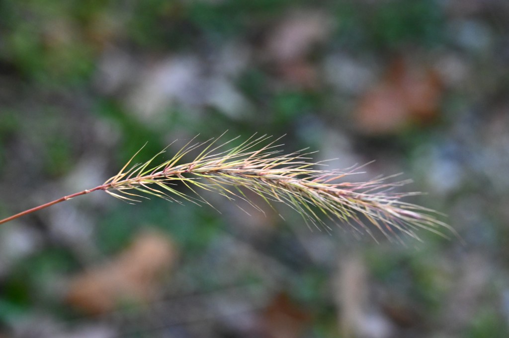
Signs of fall are everywhere.
Maybe you’ll be on a vacation somewhere in October, that would be interesting to share with us. I was just in Washington DC and I could have used photos from there, but I think I’ll try to find somewhere different this month to share for my Walktober.
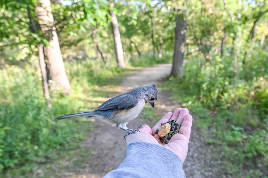
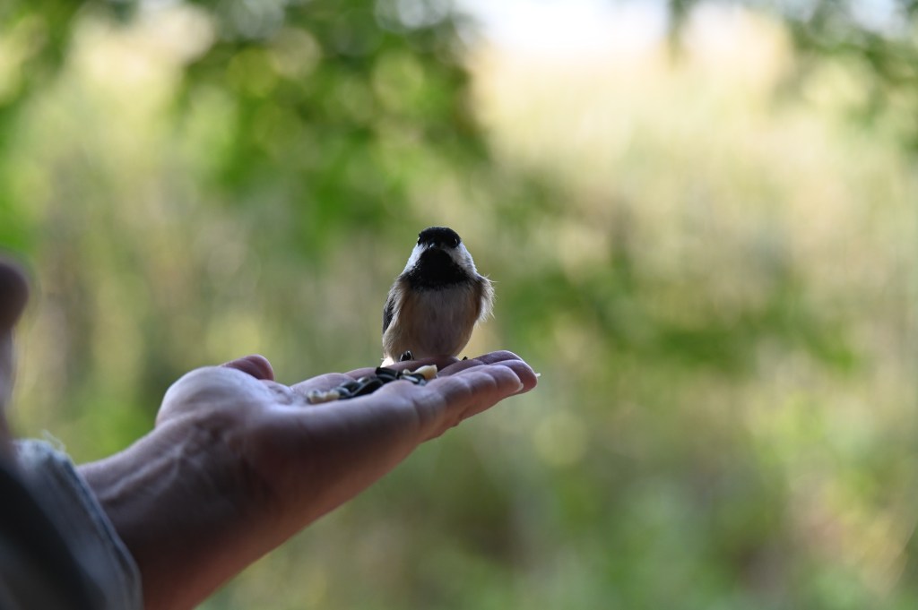
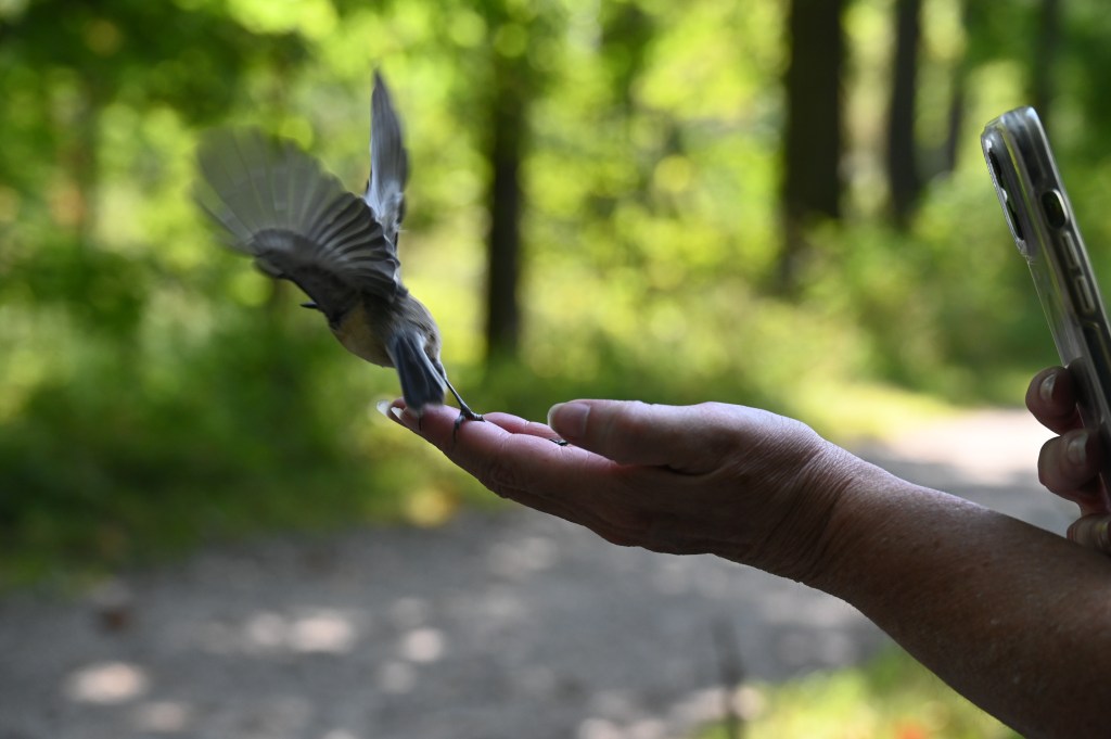
A little titmouse is curious about what we might be offering.
While I’m working on the logistics, you take a few moments and think about where you’d like to take us on your Walktober!
He got his seed to go.
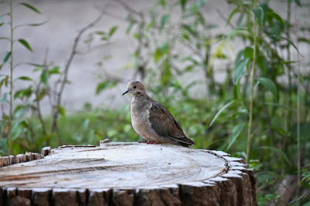
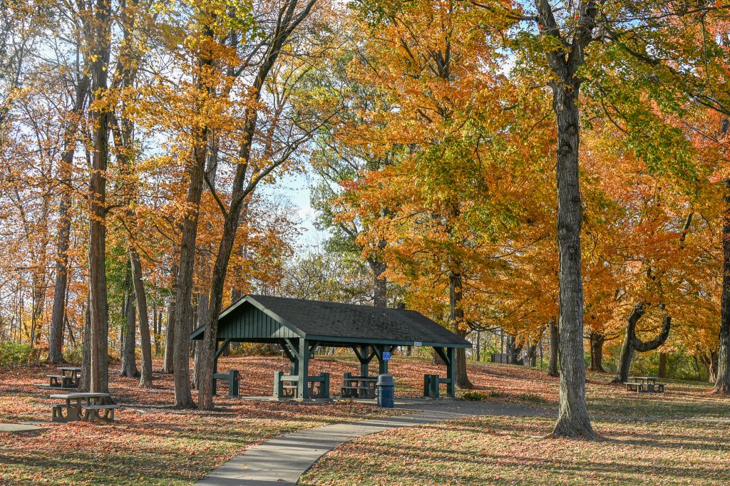
The photos in this post are from a walk at my favorite park, taken in the middle of September with a friend. This park has been featured in many of my Walktobers, and might be again.
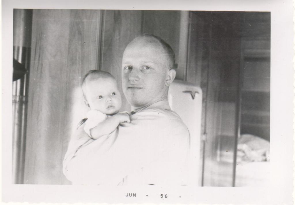
Long time readers know that my dad was killed by a tired trucker almost twenty years ago and I and members of my family volunteer with the Truck Safety Coalition, working to make our roads safer.
My dad and me many years ago.
TSC is based in Washington DC, but has families of volunteers all across the country. Of course it does, because truck crashes aren’t restricted to ‘somewhere else’ like we all want to believe.
Truck crashes happen anywhere and to anyone.
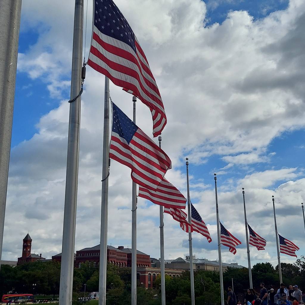
Flags at half mast for Senator Feinstein.
It takes money to keep our organization going, to pay our small staff, to help families come to DC for conferences or important meetings, to pay for grief counseling for those that want that help, to run the website that provides information to new families, and where we post our stories about the loved ones we lost and about the lives changed forever for those injured in crashes with trucks.
It takes money.
And it’s not so easy to raise money for our cause. Organizations that might have sympathy for our families, like truck part manufacturers, can’t be seen associating with us, because many of the truck companies they sell parts to are so often on the other side of our arguments. Trailer manufacturers sell to truck companies too and steer clear of us, as do some road safety equipment manufacturers and many others.
It’s hard to explain that we aren’t anti truck, we support safe trucking. It’s important to remember that truck drivers die in crashes too, and that driving a truck is one of the most dangerous jobs in our country.
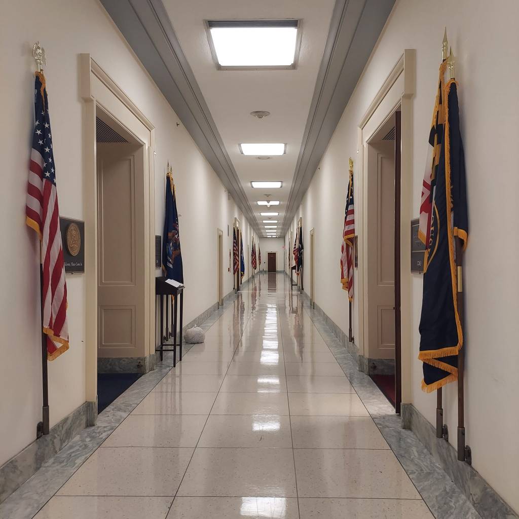
The halls of Congress where we look for support for safety.
A lot of our funding comes from individuals who have had family or friends injured or killed as well as survivors of truck crashes. The people that have already paid the price for unsafe policies and regulations continue to pay in an effort to make things better.
Every single family will tell you they continue to tell their stories, continue to come to meetings, continue to donate because they don’t want another family to experience a truck crash. Every single family comes to TSC with the same wish in their hearts.
To make it stop.
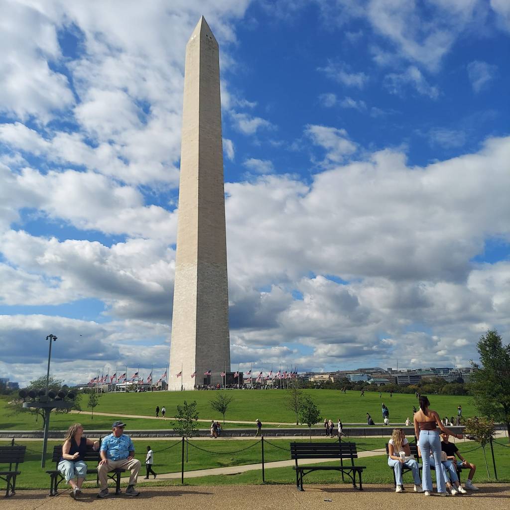
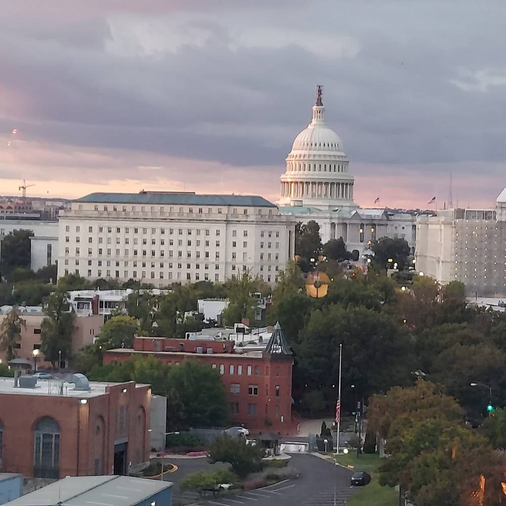
The Washington Monument during a walk after our event.
The National Highway Traffic Safety Administration says that over 5,700 people died in truck related crashes in 2021, the latest year from which we have data. That’s a 71% increase since 2009. Truck crashes are trending the wrong way. More people are being killed every year. And injuries are going up too, over 155,000 are injured every year.
Think about that. Every single year 155,000 people are injured in truck crashes. Ford Field, home of the Detroit Lions, has 65,000 seats. Every year 2.3 football stadiums of people are injured in truck crashes. And the numbers keep climbing.
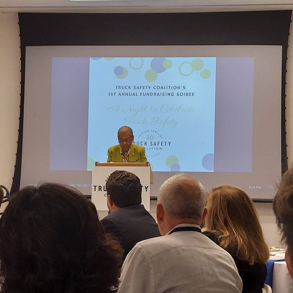
So this past weekend my husband and I traveled, on our own dime, to DC where we attended an evening of celebration of those that have contributed to TSC. Donors, safety advocates, board members, friends and supporters gathered together to recognize some very special people who, during this past year, have gone above and beyond to move our mission to make our roads safer going forward.
All waiting for something. Just like us.
It was a good evening and we raised some money. We felt warm and happy with our effort, but don’t think I won’t be asking you for support this November during Giving Tuesday. Because 5,700+ people died in 2021, and it will likely be a larger number for 2022 and 2023. Whole football stadiums of people are being injured. We can’t stop now.
Congresswoman Eleanor Holmes Norton graciously speaks to our group.
Thank you in advance for supporting me, for the dollars you donate whenever I ask, for your emotional support when I’m having a meltdown, or when I’m just missing my dad. Thank you for letting me get on my soapbox once in awhile, and for not turning away when I tell you about really sad things that make me (and many of you) really angry.
The Capitol at the end of another busy day.
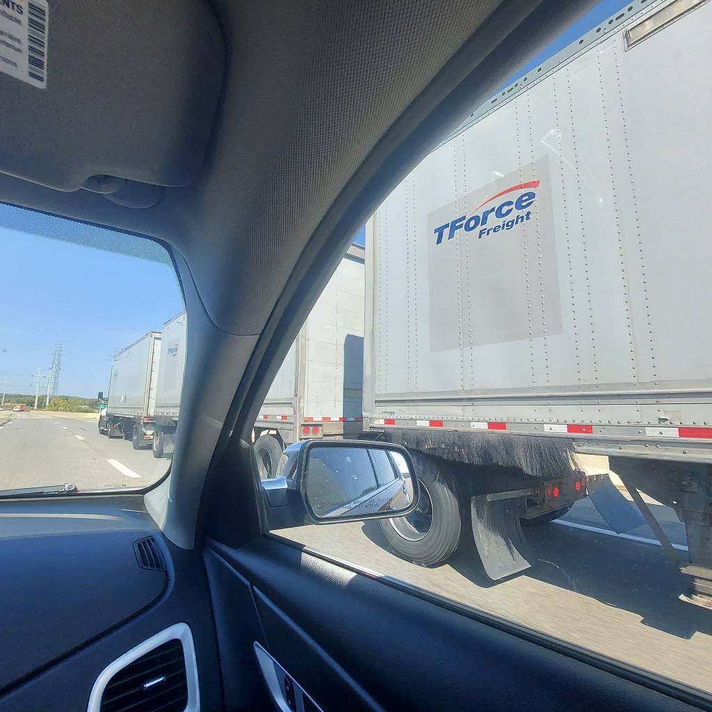
Last weekend was a time of celebration, but now it’s time to get back to work. We’re trying to get the speed limiter past the finish line at the DOT, and we’re working on getting Automatic Emergency Brakes in all trucks sooner rather than later. And don’t get me started on the minimum liability insurance issue. Or those companies that want longer trailers, and the ability to haul heavier loads. There are already triple trailers on some of our nation’s roads and we’re keeping watch so they don’t get permission to move onto more.
Passing a triple trailer truck on the Pennsylvania turnpike.
We need to keep holding our fingers in the truck safety dike. And we need money to do that.